Bude Canal System
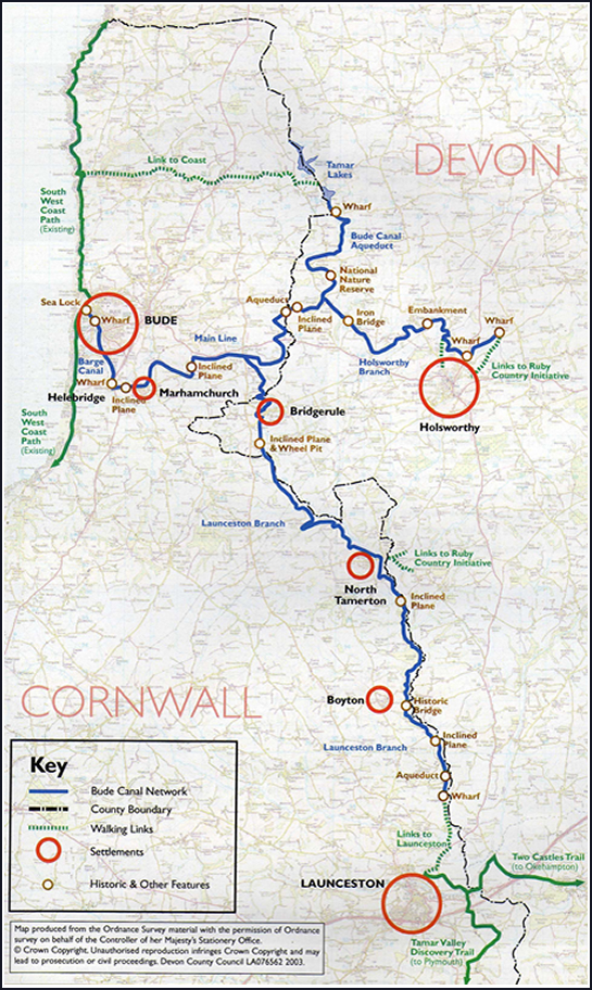
This map shows the entire network of the Bude Canal System. The network, situated on the Devon-Cornwall border, ran to a total of 35 miles in all, divided into its various branches.
At the coast is the 2 mile section known as the “Barge Canal”, as it was built to be able to operate canal barges. The remainder of the system was constructed for use by smaller “tub boats”. This comprised:
- – the Launceston branch, which ran close to the River Tamar to end about 2½ miles short of that town;
- – the Holsworthy branch, which ran east into Devon to end just north of the market town of Holsworthy;
- – the Aqueduct branch, which ran between the Holsworthy branch and Lower Tamar Lake – this branch is the length in Trust ownership.
This map is reproduced from Ordnance Survey material with the permission of the Ordnance Survey on behalf of the Controller of Her Majesty’s Stationery Office (c) Crown copyright. DCC licence no. 100019783.2010.
Clicking on the image will open another tab where you can right-click to print a copy.


